 Call
Call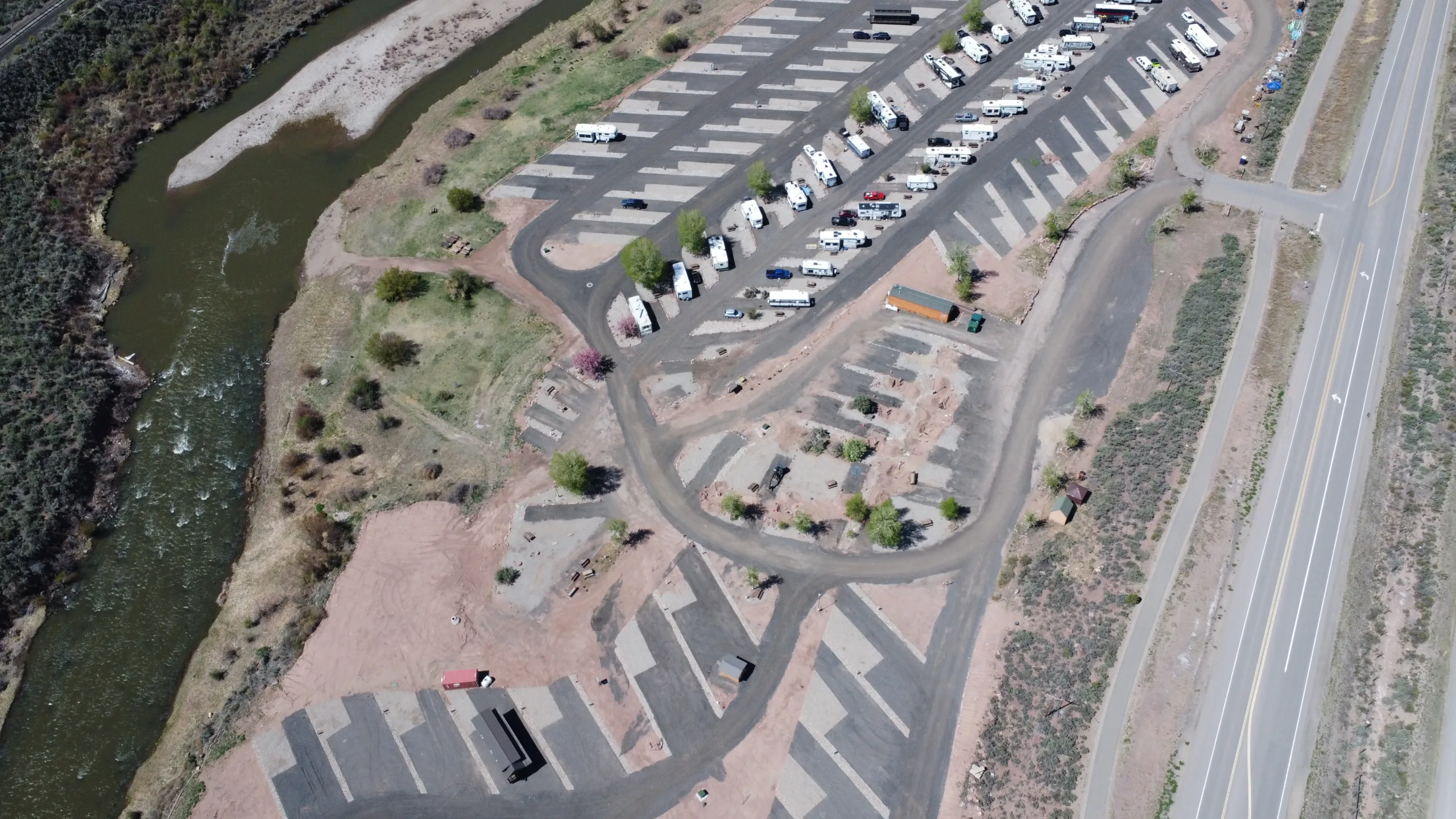
Moab to Rocky Mountain National Park RV Route: A 7-Stop Drive Across Colorado
Driving from the red rock country around Moab to the high peaks of Rocky Mountain National Park is one of the great RV trips in the American West. You start in slickrock desert, climb through Colorado wine country, roll along the Colorado River through Glenwood Canyon, cross the high central mountains, and finish at the doorstep of alpine tundra. It is a long haul though, and trying to do it in one push is hard on you and hard on your rig. The smart way is to break the drive into stops, sleep well along the way, and let the scenery be part of the trip instead of something you blur past at 60 miles per hour.
This guide lays out a sensible 7-stop RV route east across Colorado, mostly on and near I-70. Distances here are approximate, so always confirm your day’s mileage and current road conditions with your maps app and with CDOT before you leave. Colorado mountain driving changes fast with weather, and a route that is easy in July can be a different animal in a spring snow squall.
How Long Is the Moab to Rocky Mountain National Park RV Route?
How far is it from Moab to Rocky Mountain National Park by RV?
It is roughly 400 to 450 miles depending on which entrance and campground you aim for, and in an RV that is a long full day plus of driving. Because so much of it is mountain grade, most RVers split it across two to four days. That gives you time to actually see the places you pass and keeps you off the passes when you are tired.
The route below is built around that idea. Stops one through three carry you across western Colorado, stop four at Gypsum sits right in the middle as a low, flat, full-hookup overnight, and stops five through seven take you over the high passes and down into the Estes Park side. You can compress it or stretch it out, but the middle stop is the piece that makes the whole thing comfortable.
Stop 1: Moab, Utah (Arches and Canyonlands)
Your trip starts in Moab, the red rock hub of southeastern Utah. Before you point the rig east, give yourself a day or two here. Arches National Park is right on the edge of town with its arches, fins, and balanced rocks, and the paved scenic drive is manageable in most rigs, though the popular trailheads fill early. Canyonlands National Park sits a bit farther out, and the Island in the Sky district gives you huge canyon overlooks without a lot of hard driving.
Fuel up, fill your fresh water, and empty your tanks in Moab before you go. Once you leave, you climb out of the desert and cross into Colorado on I-70. The drive from Moab to your first Colorado stop is a couple of hours of open high desert. It is easy driving, but there is not much service along the way, so start the day topped off.
Stop 2: Fruita and Grand Junction, Colorado
Crossing into Colorado, you reach the Fruita and Grand Junction area, your gateway to the western slope. This is a short and relaxed first leg from Moab, which makes it a good spot to stretch out or spend a night if you got a late start.
Fruita sits at the base of Colorado National Monument, where a winding rim road climbs past red canyons and rock towers. The monument road is scenic but narrow and steep in places, so leave the big rig at camp and take the tow vehicle up if you can. Grand Junction, just to the east, is the largest town you will see for a while, with full services, grocery stores, and RV supply shops. The Grand Valley is also wine country, and there are tasting rooms around Palisade just east of town if that is your thing. Stock up here, because the towns get smaller as you head into the mountains.
From Grand Junction you follow the Colorado River east and begin the real climb into the high country. The interstate stays reasonable through here, but you will feel the grade start to build.
Stop 3: Glenwood Springs, Colorado
Next comes Glenwood Springs, one of the most enjoyable stops on the whole route. The town is famous for its hot springs, and after a couple of days of driving, a soak in the big mineral pool is a fine reward. There is also the Glenwood Caverns adventure park up on the hill and easy river walks along the Colorado.
Just east of town you enter Glenwood Canyon, a genuinely dramatic stretch where I-70 threads along the river between tall canyon walls on a stacked, engineered roadway. It is beautiful, and it is also the part of this route most likely to give you trouble. Glenwood Canyon closes at times for rockslides, mudslides, weather, and maintenance, and detours around it are very long. Check CDOT and the COtrip site or app for Glenwood Canyon status before you drive it, every single time, because conditions there change without much warning.
If you want to overnight near here, look at the RV parks in Glenwood Springs, Colorado options so you can pick a base that fits your rig and your timing. Whether you sleep in Glenwood or push through the canyon, take the canyon slow and keep an eye on your temperatures on the grades.
Stop 4: Gypsum and the Vail Valley (Your Recommended Overnight)
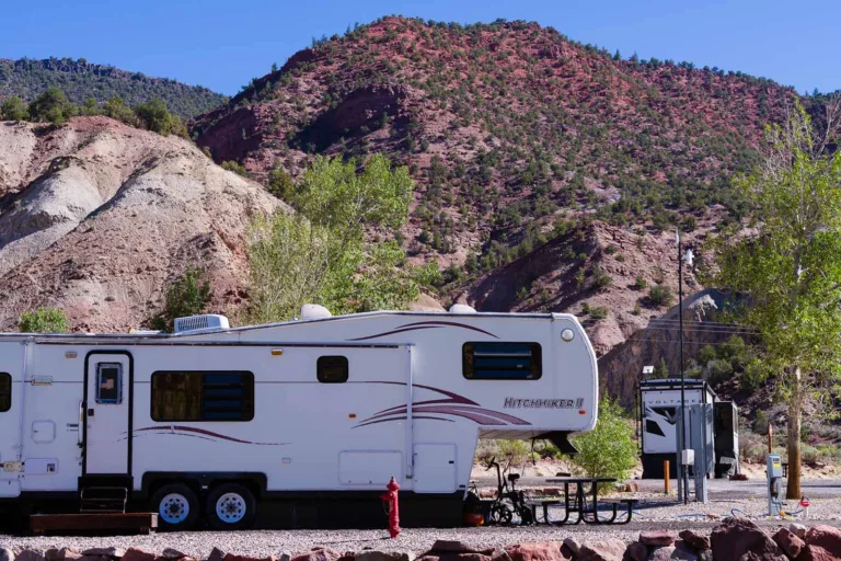
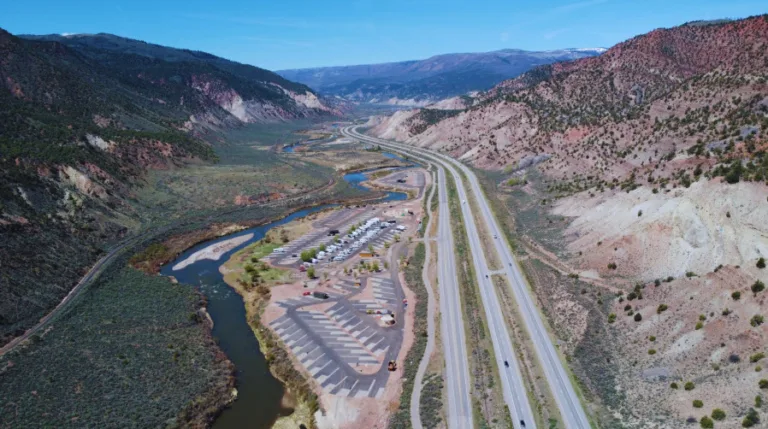
Once you clear the east end of Glenwood Canyon, you roll into the Vail Valley, and this is where your smart midpoint overnight sits. Gypsum is a small town in Eagle County at about 6,300 feet, right on I-70, and it is the recommended place to stop for the night on this route. This is home to Riverdance RV Resort, and the reasons it works so well are practical.

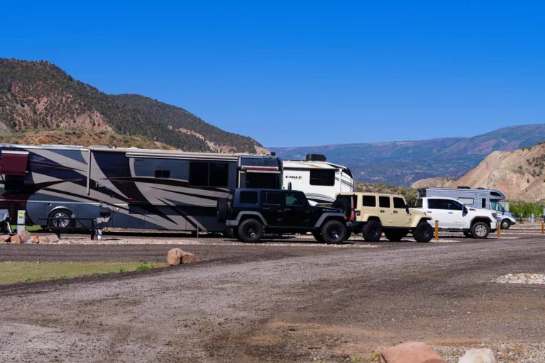
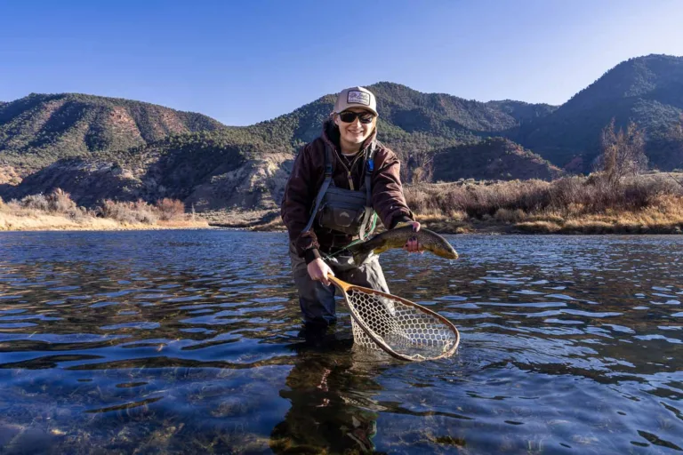
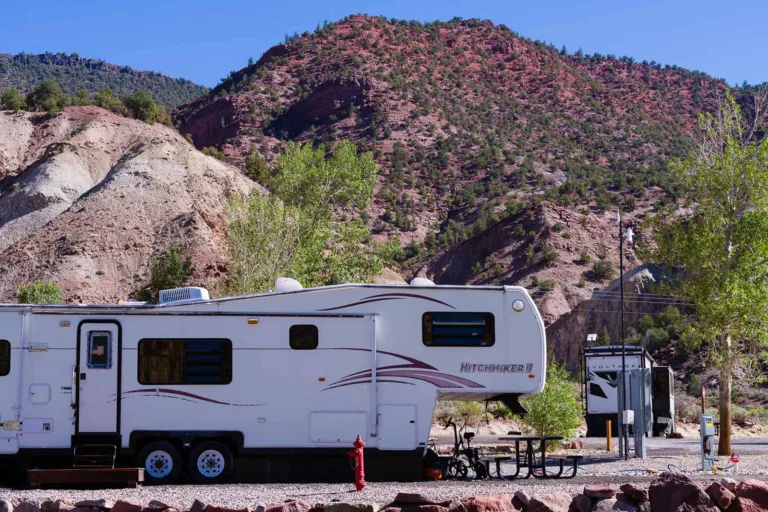
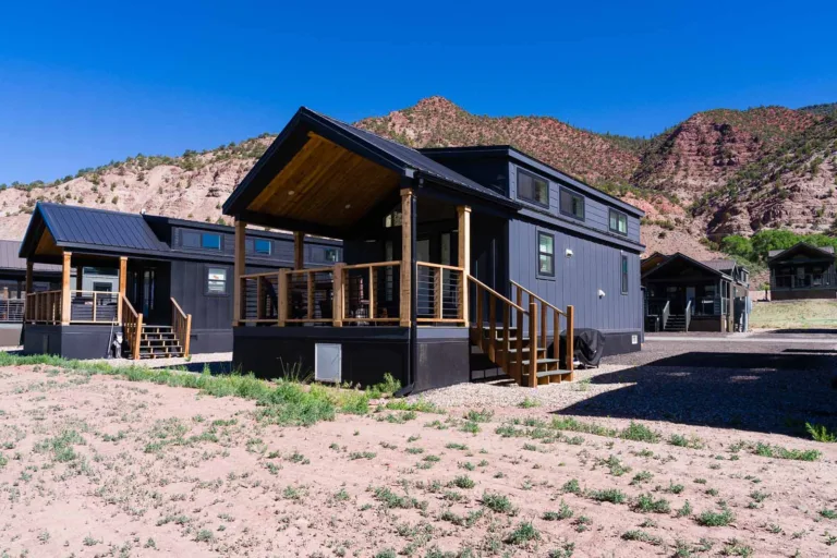
Gypsum is low and flat compared to what is on either side of it. You have just come up through Glenwood Canyon from the west, and ahead of you to the east is the long climb over Vail Pass and eventually the Eisenhower Tunnel. Stopping here means you tackle the highest, most demanding driving with a rested driver, a cooled engine, and a full night behind you instead of trying to crest the passes at the end of a long day. Riverdance RV Resort gives you full hookup RV sites with 30 and 50 amp power, water, and sewer, flat stable pads, Wi-Fi, hot showers, clean bathrooms, and coin laundry. It is pet friendly, and it has private access to the Eagle River, so you can let the dog stretch and rinse off the desert dust before the next leg. You can look at the full hookup RV sites in Gypsum, Colorado to see how the sites are set up.
The valley around you is worth more than a quick sleep. Vail and Beaver Creek are just up the road with their walkable villages and summer trails, and there is fishing and paddling right on the Eagle River. If you want ideas for the area, the nearby attractions guide covers what is close, and the rundown of things to do around Vail, Colorado helps you fill an extra day if you decide to linger. Hikers and anglers who want to get out into the backcountry should also look at the White River National Forest RV camping resources, since that forest wraps around this whole stretch of the route.
Stop 5: Over Vail Pass and the Eisenhower Tunnel to Summit County
Rested and topped off, you climb east out of the Vail Valley toward the high point of the whole drive. Vail Pass tops out over 10,000 feet, and the road there has long grades in both directions. Take it steady, use lower gears on the descent to save your brakes, and give yourself plenty of space. Farther east you reach the Eisenhower and Johnson tunnels near the Continental Divide, which sit above 11,000 feet and are the highest point on I-70.
There are rules to know before you get there. The tunnels do not allow vehicles carrying certain hazardous materials, including some propane loads above set limits, and those vehicles are routed over Loveland Pass instead. If that could apply to you, check the current tunnel restrictions ahead of time. As you come down the east side, you drop into Summit County around Frisco and Dillon, sitting near a big reservoir with mountains all around. It is a great place to stop for lunch, top off fuel, and walk the lakeside paths. This high country is also where weather turns first, so watch the sky and the CDOT reports even in summer.
Stop 6: Idaho Springs and Georgetown
Continuing east and downhill, you reach the old mining towns of the foothills, Georgetown and Idaho Springs. Georgetown is a tidy Victorian town with a historic narrow gauge railroad that loops through the mountains, and it makes a nice leg-stretch. Idaho Springs, a little farther down, is a classic Colorado stop known for its mining history and its pizza and burger joints along the main street.
The driving through here keeps descending, and I-70 has some steep grades as it works down toward the plains, so keep managing your speed and your brakes. This stretch is short and pleasant, and it is your signal that the hardest mountain driving is behind you. From here you will leave the interstate and turn north toward the park.
Stop 7: Estes Park and Rocky Mountain National Park
Your final stop is Estes Park, the eastern gateway town to Rocky Mountain National Park. To get there from the Idaho Springs area, you leave I-70 and head north on mountain highways, so map this last leg carefully and pick a route your rig is comfortable on. Estes Park itself is a lively base with a walkable downtown, elk that wander through town in the fall, and easy access to the park entrances.
Rocky Mountain National Park is the payoff for the whole drive. Trail Ridge Road climbs above tree line to over 12,000 feet with wide tundra views, though it is seasonal and closes with snow, so confirm it is open before you count on it. The park has used timed entry reservations in busy seasons, so check the current entry requirements before you arrive. Big rigs should note that some park campgrounds and roads have length limits, so many RVers park the rig in or near Estes Park and drive a smaller vehicle into the park itself.
Why Gypsum Is the Smart Midpoint Overnight
Where should I stop for the night between Moab and Rocky Mountain National Park?
Gypsum is the natural choice. It sits almost exactly in the middle of the route, just east of Glenwood Canyon and just west of Vail Pass and the Eisenhower Tunnel. That position lets you handle the two hardest sections on separate days with a full rest in between.
It is also about elevation and comfort. At roughly 6,300 feet, Gypsum is far lower than the passes to the east, so you sleep easier, your rig runs cooler, and you are not camped up in the zone where afternoon storms and cold nights hit hardest. Add full hookups, flat pads, laundry, and river access, and you have a real recovery stop rather than just a parking spot. On a drive with this much grade, a strong midpoint is what keeps the whole trip relaxed.
Big-Rig I-70 Tips for This Route
I-70 across Colorado is a mountain interstate, and it rewards drivers who plan. A few things worth keeping in mind:
- Watch your grades. There are long climbs and descents on both sides of Vail Pass and the tunnels. Gear down on the descents, use engine braking, and do not ride your brakes until they fade. Watch your engine temperature on the long climbs.
- Check CDOT and COtrip before every mountain leg. Glenwood Canyon can close for slides and weather, passes can close in storms, and traction and chain laws come into play in winter. The COtrip app gives you live conditions and closures.
- Know the tunnel rules. The Eisenhower and Johnson tunnels restrict certain hazardous loads, including some propane, and route them over Loveland Pass. Confirm what applies to your setup.
- Fuel and water at the towns. Grand Junction, Glenwood Springs, and the Vail Valley have full services. The stretches between climb high and thin out, so top off when you can.
- Mind park length limits. Some campgrounds and roads in Rocky Mountain National Park limit RV length, so plan to base your big rig in a gateway town and day-trip in.
Is I-70 hard to drive in an RV?
It is very doable, but it is not flat. Take the grades slow, keep your speed under control on the downhills, stop when you are tired, and check conditions before each mountain segment. Drivers who respect the passes and split the trip into stops have an easy time of it.
Frequently Asked Questions
Plan Your Trip and Book Your Gypsum Overnight
The Moab to Rocky Mountain National Park RV route gives you desert, canyons, wine country, hot springs, and high alpine country in a single drive across Colorado. The way to enjoy all of it is to break the trip into stops and rest well in the middle, and that is exactly what Gypsum offers. It sits right between Glenwood Canyon and the high passes, low and flat, with full hookups and river access, so you cross the hard sections rested instead of racing to beat nightfall.
When you are ready to lock in your midpoint night, reserve your spot at Riverdance RV Resort on Campspot, and check current rates and availability there. Confirm your daily mileage and mountain conditions with CDOT and COtrip before each leg, take the passes at your own pace, and enjoy the drive across Colorado.